I-17 to Bloody Basin Road, Road 9014 South.
We stopped at "Stuck Truck Hill", where we were once stranded, stuck in the mud, on a fateful camping many years ago.
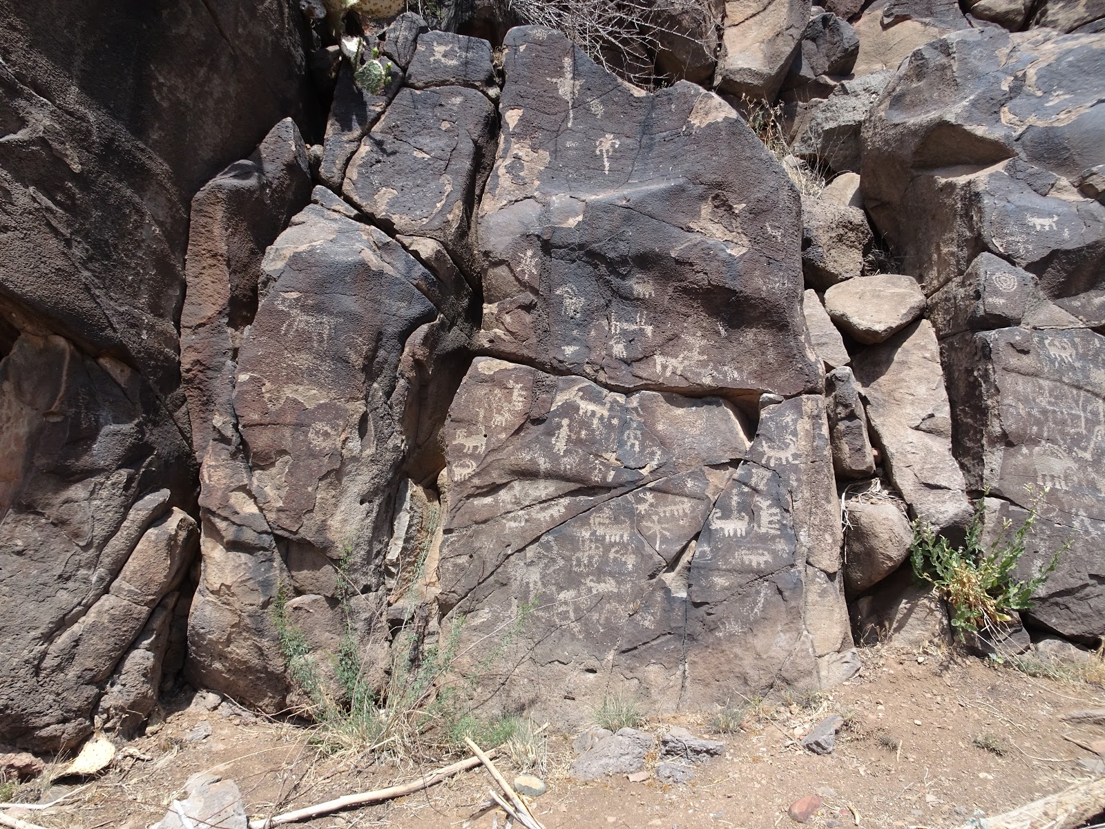
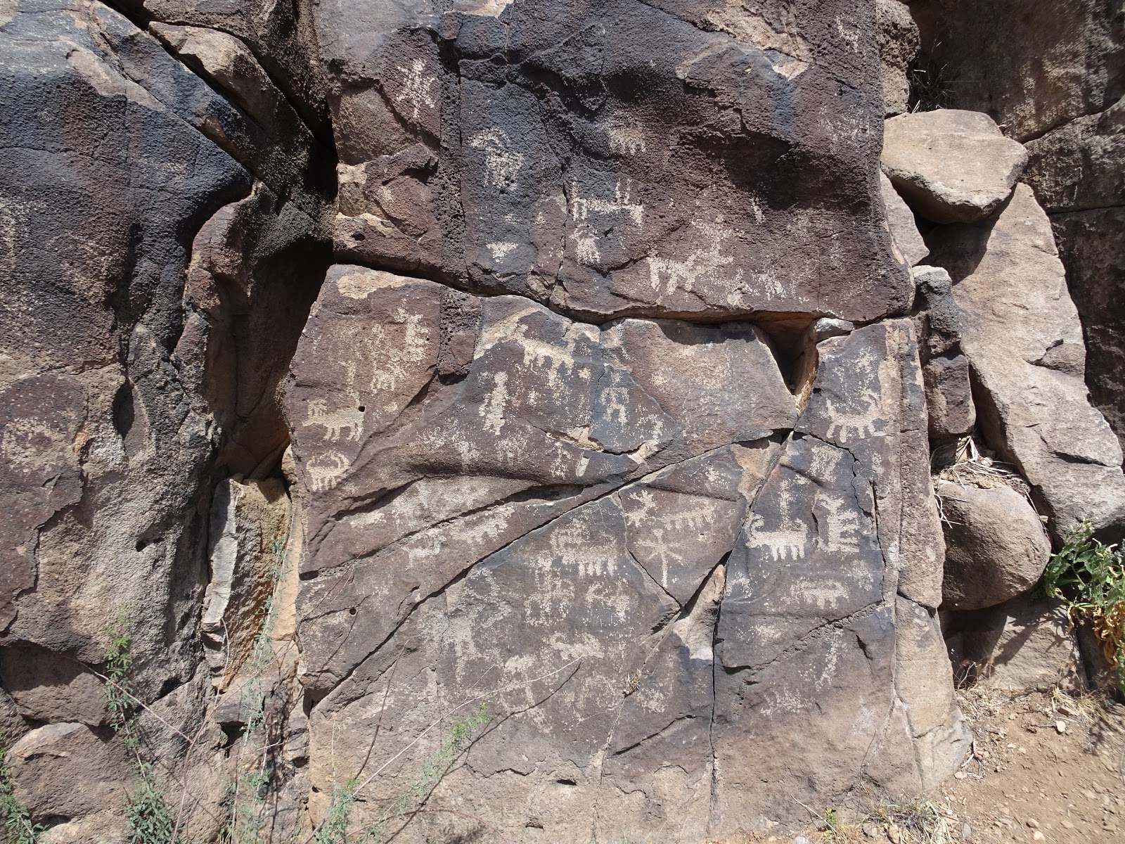
Onward to the site we have since nicknamed the "Brooklyn Mine Ruin". This site has a huge amount of of Native-American Petroglyphs, which are drawings that are "pecked" or chiseled into the rock. We had seen and admired these on the camping trip back in the sixties, and Harry had actually gone back in as a young adult with a large camera and taken some pictures.
Ellen and I wandered down and admired the drawings; Harry was flying his drone. Dad stayed back in the shade at the truck. Here's some pics.


Ellen takes a lot of pictures, and many of them are better than mine.
Link to Ellen's pictures.
Link to Harry's drone video.
It's important to include that on all of these early trips we were getting oriented about the area and having lots of discussions about where the various roads go, and trying to match that with Harry's and Dad's memory of having visited what they thought was a Spanish Fort in the general area.
On this trip, we proceeded South on Road 14, in the pursuit of the probably mythical Spanish Fort. We went maybe a half mile or so, the road got too rough, and we turned around.
It turned out Harry was thinking we were on a completely different road, which leads an area he thought was the location of the Fort. It turns out that we weren't on the road that he was thinking of, and since then the thinking has also been changed about the possible location of said Fort. If you think that is confusing, you should come along on a trip and hear some of the actual discussion. Then you would be even more confused.
That was about enough exploration for the day, so we headed back North towards the BB road, and stopped at what has since been named "Blood Corral". It's a minor cattle corral that straddles road 9014, about a mile south of the BB road. Dad scratched his arm on some barbed wire while looking around for souvenir "date nails", that can sometimes be found in old railroad ties used in construction. We're all set for minor first aid, and we cleaned him up and slapped on some band-aids.
On home towards Phoenix; we stopped at Outback on I-17 and Dunlap for a well-deserved late lunch.
Another great trip!
Link to Ellen's pictures.
Link to Harry's drone video.
For future reference, here's some mileages:
It's about 80 miles from East or South Phoenix to the Bloody Basin Road turnoff. (Bloody Basin is actually some distance East from the area we're visiting lately, so that's just the name of the road.)
Proceeding East on BB road, here are the landmarks.
Power Line: 3.8
Creek Crossing: 4.7
Bathroom: 5.8
Pueblo La Plata Turnoff: 8.1
Kiosk, Rd. 9014 Turnoff: 10.4
Reset Odometer, proceeding South on Rd. 9014
Blood Corral: 1
Monument/Forest Border: 2.3
Turnoff to Road 611: 2.5
Stuck Truck Ridge: 3.1
Turnoff to Road 599 (The Y): 4.2
(continuing on 599)
Turnoff to Road 610: 4.6
Road to Squaw Creek?: 6.6
(I think this is 3164)
Squaw Creek Village: 7.2
I love the confusing paragraph about the confusion of being confused. It was all true. I think. Wait...yeah it was true. Under the mileage landmarks, I think instead of "creek crossing" it should say Agua Fria River crossing. And then the turnoff to 599 really being the turnoff to 610 (which then 599 branches off and heads to the SCR). Wonderful trip! Good Blog Lenny!
ReplyDelete